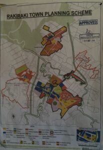
The Rakiraki Town Council planning scheme sets out the way land is to be used and developed, classifies areas for land use and includes provisions to coordinate infrastructure within the local government area. The scheme is divided into two parts:
- The scheme maps and height plans which set out the zoning, coding and maximum heights for each property; and,
- The scheme text which sets out the specific development controls which apply to each property